Data Acquisition
3D-Modeling
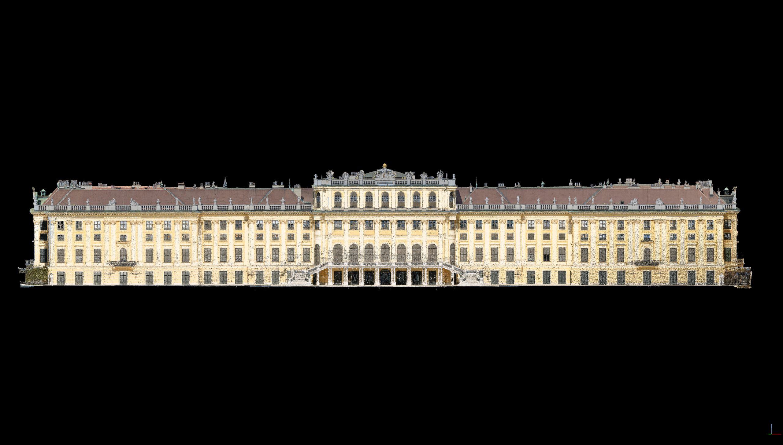
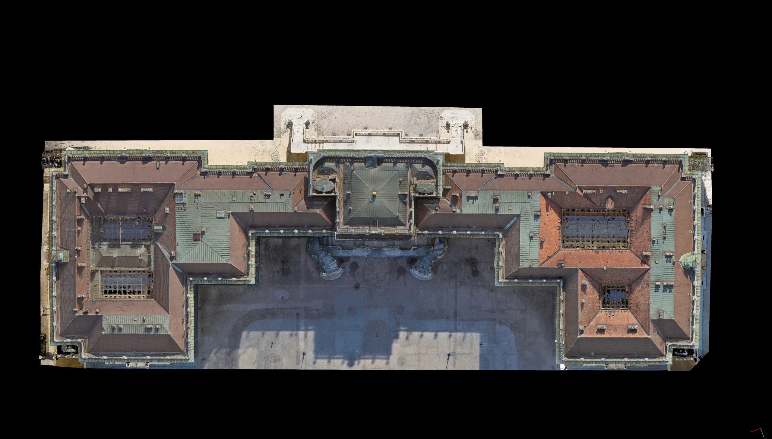
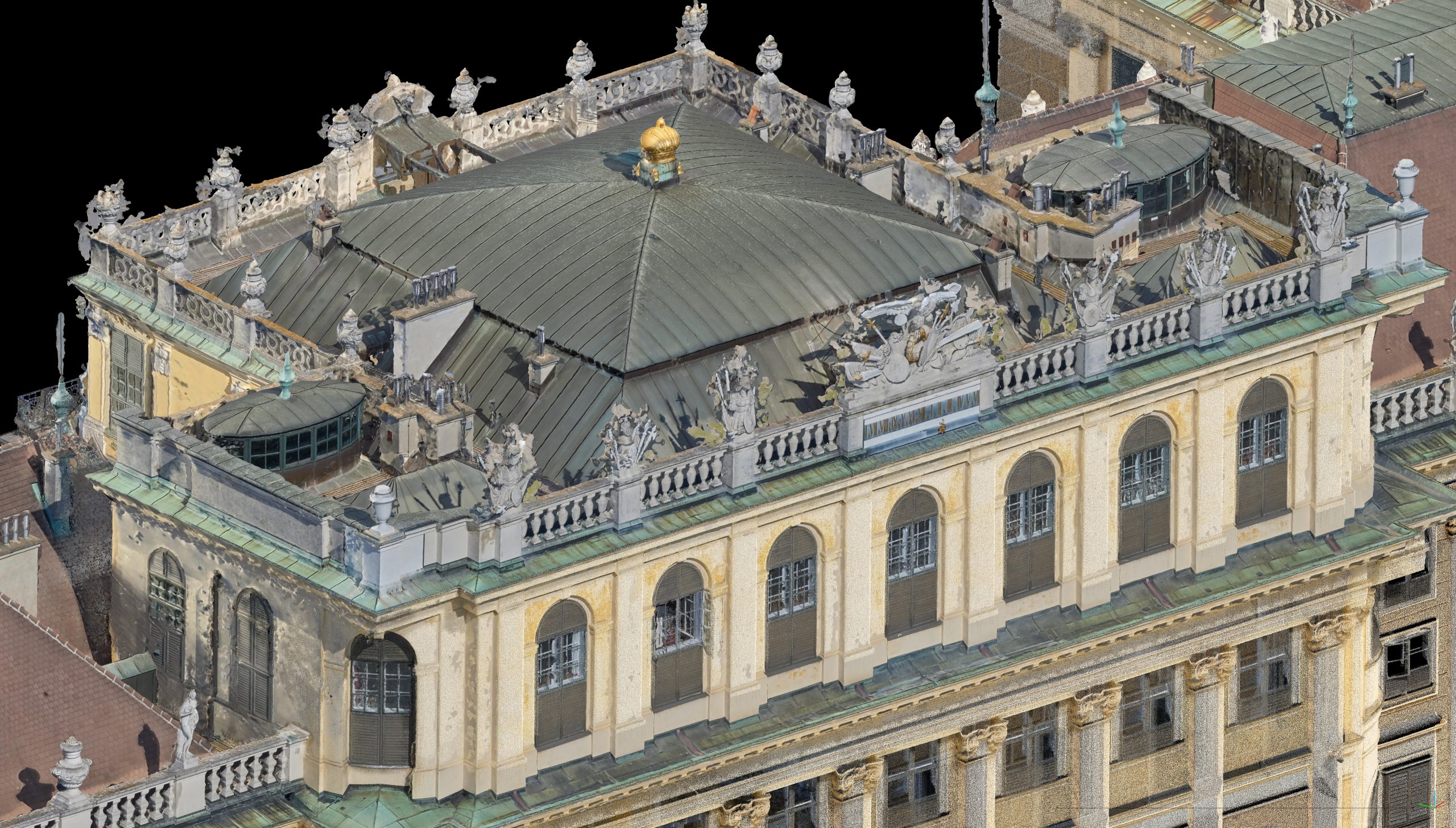
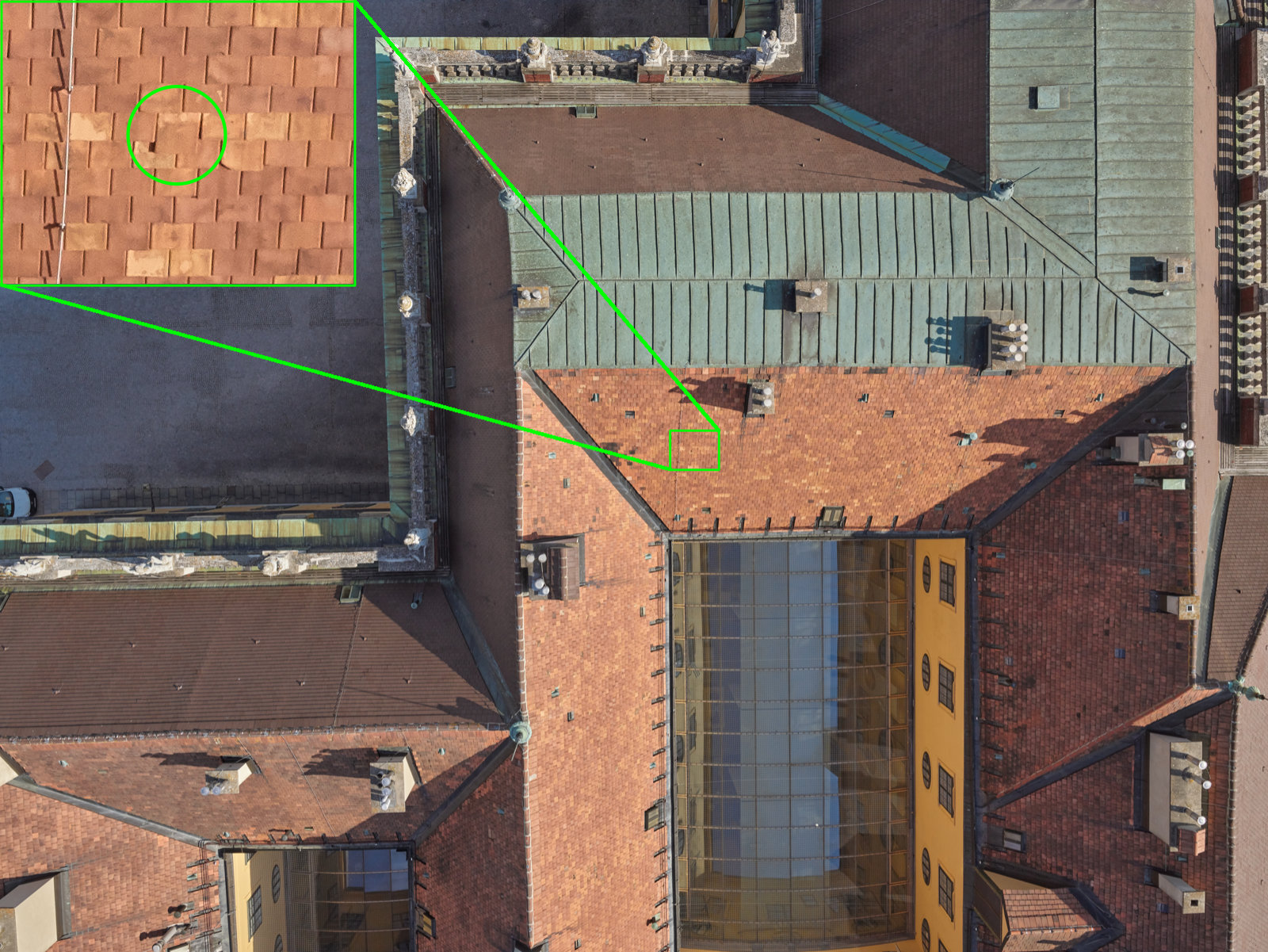
A ground sampling distance of 3,6 mm is enabled by 458 photos with 100 Megapixel. Indiviudal bricks and the entire roof infrastracture can be inspected on basis of individual photos or using a high-resolution textured 3D model. For proper facade representation, 292 scanning positions have been captured covering the highly detailed staircases as well. In combination with the UAV-based image data, a complete 3D representation of the entire building is enabled.


Interactive 3D-point-cloud

To achieve highest resolution, set “point budget” to 10,000,000. In case of non-smooth visualizaion, reduce the band-width.
Select appropriate Navigation:
- Earth Control: LMB = rotate; RMB = pan; Scroll = zoom; Left-Double-Click = Jump to position
- Fly Congtrol: LBM = rotate; RMB = pan; arrow key = move in camera direction
- Helicopter Control: LBM = rotate; RMB = pan; arrow key = move at constant height above terrain
High-resolution image


Interactive 3D-Model
Credits:
on behalf of Schloß Schönbrunn Kultur- und BetriebsgesmbH
supported by RIEGL Laser Measurement Systems GmbH
supported by Phase One Industrial
in cooperation with Gecko4K
using Potree for interactive 3D-visualization